



During the American Association of State Highway and Transportation Officials 2026 Safety Summit in Hartford, CT, a session explored how cutting-edge data collection methods can help transportation agencies make more informed decisions and improve roadway safety.
[Above photo by AASHTO]
Entitled “Emerging Data Collection Methods for Safety” and moderated by Jason Siwula, deputy state highway engineer for the Kentucky Transportation Cabinet, the session’s panel featured Samuel Harris, state traffic engineer for Georgia Department of Transportation; Ron Knezevich, state safety engineering supervisor for the Georgia DOT; Aaron Nash, GIS project manager for the Connecticut Transportation Research Safety Center at the University of Connecticut; and Stephen Read, state safety engineer for the Virginia Department of Transportation.
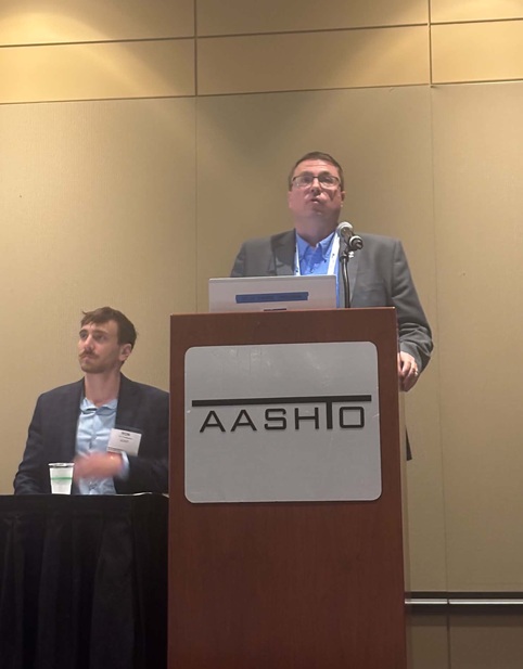
KYTC’s Siwula explained in his remarks that an ongoing evolution of data sources is helping transportation agencies better understand roadway conditions, traffic patterns, and safety challenges.
“And the more successful each of you are [at preventing crashes], less and less conventional data will be there,” said Siwula. “Not having crash data is a great problem to have. However, we need to come up with alternative data types. We are going to look for new opportunities to leverage other data.”
Showcasing the importance of collaboration, Georgia DOT’s Harris highlighted a partnership with local municipalities to purchase data through the Eastern Transportation Coalition’s data marketplace.
This effort allows transportation agencies to merge resources and jointly acquire transportation data, reducing costs while expanding access to critical information. “It is just a virtual data Costco,” Harris said.
He also emphasized the Joint Agency Data Acquisition and Management Program; a partnership between the Georgia DOT and the Atlanta Regional Commission that seeks to improve how transportation data is collected, shared, and analyzed. The initiative is designed to enhance and standardize data analytics capabilities across transportation projects. By sharing data, this program permits validated data across the roadway network while reducing costs and supporting informed safety decisions, Harris said.
“We are purchasing data through this group for the entire state,” he noted. “That means that all projects are equal and lowers overall agency cost.”
Highlighting real-time travel and speed data, Georgia DOT’s Knezevich explained how congestion scans can help identify bottlenecks along a corridor. By incorporating AASHTOWare Safety into its safety analysis tools, he said Georgia DOT is using these new data collection resources to catch driver speeds.
One of these emerging data tools is using “speed bins,” which groups vehicles into speed ranges to help transportation agencies analyze traffic patterns and identify potential safety concerns, Knezevich noted.
“I have a new favorite way of looking at speeds and that is speed bins,” he emphasized. “You get to see the whole spectrum of speeds here.”
Exploring telematics data, which is collected from connected vehicles, mobile devices, GPS systems, and other technologies, Knezevich discussed how Georgia DOT is using the information to support initiatives such as advisory speed identification, wrong-way driving detection, and network scans for roadway reconfigurations. By analyzing vehicle volumes and lane configurations, the agency can identify corridors where roadway redesigns may improve safety and operations, he pointed out.
“Instead of looking for bottlenecks, we looked for places where we could remove lanes and add multimodal lanes without reducing traffic flow,” Knezevich explained. “This new data enables different types of safety analysis. There are things that we could never do at this level that we can do today.”
Highlighting a new collaboration between the University of Connecticut and the Connecticut Department of Transportation, Nash discussed how Geographic Information System or GIS technology could be a game changer for roadway safety. GIS is a computer-based mapping and analysis tool, he said, that allows agencies to collect, visualize, and analyze data tied to specific geographic locations, helping transportation professionals distinguish trends and pinpoint safety risks.
Using GIS technology, the school is helping Connecticut DOT develop a comprehensive Pavement Marking Index – which measures and rates the condition of roadways through pavement markings. Calling it the Pavement Marking Retro-Reflectivity Inventory, Scheduling, and Management or PRISM program, Nash explained how the initiative provides a systematic approach to inventorying, assessing, and managing pavement markings across the state’s roadway network.
“Our goal is for everyone in the organization to use it and make better decisions with the data they have,” Nash noted.
Capping off the panel, VDOT’s Read shed light on the Data Analytics System for Highway Safety or DASH program. The initiative brings together the Virginia Department of Motor Vehicles, Virginia State Police, and Virginia Tech University into a strategic partnership aimed at advancing data-driven decision-making.
As an operational tool, he explained that DASH integrates crash records, roadway imagery, real-time speed data, interactive mapping tools, and other roadway and traffic datasets into a single platform. The system enables transportation and public safety agencies to identify crash trends, pinpoint high-risk locations, and evaluate the effectiveness of safety improvements, supporting more informed, data-driven decision-making, Read noted.
“With this tool, it is really helpful for our enforcement community to compare that crash data over multiple years and compare it to the real-time speed data,” he explained. “They can drill down into information on the corridor they are interested in and drill down into where the issues are.”
 Top Stories
AASHTO Safety Summit: Managing Speed with Technology
October 9, 2026 Top Stories
