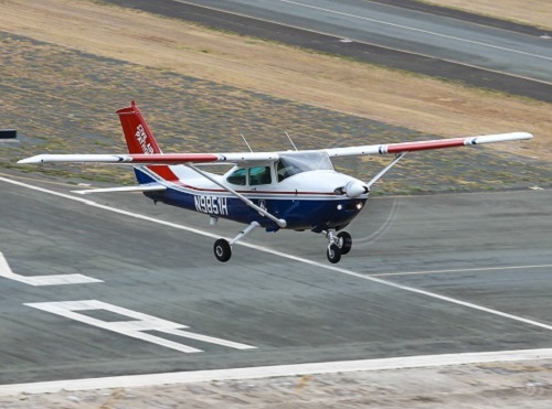
The Civil Air Patrol or CAP and uAvionix are joining forces to deploy new receiver networks to complement Federal Aviation Administration sensor data with low altitude aircraft positions in support of the CAP’s mission to shorten aviation crash-to-rescue timelines.
[Above photo by the CAP]
Through the leadership of its Virginia Wing, CAP volunteers have assisted uAvionix in locating suitable receiver sites and supported the installation of small, low weight FlightStation ADS-B receivers at various airports across Virginia.
The dual-mode FlightStation receivers receive transponder data from aircraft, which is centrally received and transmitted to the NRAT server at Maxwell Air Force Base, where it is then combined with FAA sensor data.
As a result, Virginia is the first state to have 100 percent coverage down to 500 feet of altitude; a capability that is rapidly expanding to other states, uAvionix noted in a statement.
The CAP’s National Radar Analysis Team or NRAT uses FAA data and other technologies in support of the CAP emergency services teams, which are activated by the Air Force Rescue Coordination Center or AFRCC when there is a report of a possible missing aircraft or crash.
Once a team is activated, analysis and actionable data can now be provided in minutes to an incident commander, instead of days or hours, to conduct search and rescue operations.
The FlightLine roll-out consists of several Air Traffic Control or ATC-grade ADS-B receivers with overlapping coverage, allowing for the validation of transmitted ADS-B data to better pinpoint positions at low altitudes, whereas traditional ADS-B and radar concentrate mostly on airports and higher altitudes.
“NRAT has been working several years to test small ADSB receivers to place at locations with limited FAA coverage,” explained Lt. Col. Mark Young, NRAT commander.
“The availability of these new receivers and subsequent real time data from FlightLine data available to CAP is a significant advancement,” he said. “Real time data at lower altitudes significantly improves NRAT’s ability to provide a fast and accurate location of missing aircraft that can be used to support the search and rescue mission and will result in lives saved.”
 Nation
North Dakota DOT Profiled in State DOT Update
July 3, 2025 Nation

