


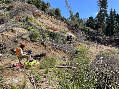
The Oregon Department of Transportation recently began the next phase of subsurface investigative work into a massive landslide that closed a section of OR 229 in December 2025; a critical step to guiding the agency’s highway repair effort.
[Above photo by Oregon DOT]
The agency said that it is conducting a geophysical survey near the bottom of the landslide; a non-invasive engineering procedure that maps underground soil and rock layers without excavation.
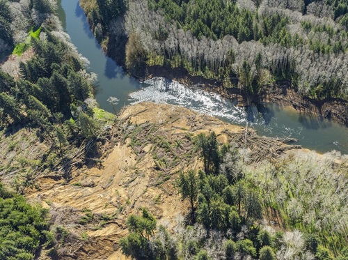
The information gathered from that survey will help guide drilling teams and refine where additional subsurface exploration is needed, Oregon DOT noted in a statement.
Next comes the deployment of heavy equipment to create temporary access paths for geotechnical drilling units to safely reach investigation sites.
Crews will move fallen trees and grade rough paths while minimizing disturbance to the landslide, the Oregon DOT said.
During that drilling work – expected to continue through October – engineers will collect soil and rock samples and install monitoring equipment in each drill hole.
After drilling is complete, Oregon DOT said it will continue monitoring the sites to better understand how the landslide moves over time and how groundwater affects slope stability, especially during the winter months.
The agency explained that this subsurface investigation will help engineers map underground soil and rock layers, determine how deep the landslide extends, measure groundwater levels, monitor ongoing ground movement, and finally design long-term highway repairs and slope stabilization measures.
 States
Larry Flynn Named as Director for Montana DOT
October 2, 2026 States
