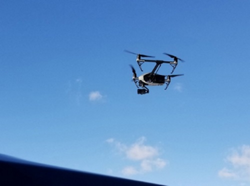
The MITRE Engenuity Open Generation 5G Consortium plans to test 5G-equipped aerial drones along New York State 50-mile unmanned aircraft systems or UAS corridor between the cities of Syracuse and Rome.
[Above photo by the New York Governor’s Office]
New York-based nonprofit NUAIR, which manages that UAS corridor, will help the consortium establish an “experimentation hub” offering more than 100 square miles dedicated to 5G beyond-visual-line-of-site testing and long-range flight paths for drones along that passageway.

“Our drone corridor being selected for the launch of the nation’s first 5G unmanned aircraft systems testing range further positions our state –specifically the Central New York and the Mohawk Valley region – as the global leader in the market for this cutting-edge technology,” noted Governor Kathy Hochul (D) in a statement.
NUAIR CEO Ken Stewart added that this project makes New York the first Federal Aviation Administration-designated UAS test site with a bespoke 5G network.
“The industry is looking for an FAA and FCC [Federal Communications Commission] approved communications network that has the capability and reliability needed for safe commercial drone operations,” he pointed out. “5G holds the promise of unlocking scalable, economically viable drone operations and we are confident that our work in New York will help determine if 5G is a suitable solution for the UAS industry.”
State departments of transportation across the country are supporting drone development in a number of ways.
For example, when the U.S. Department of Transportation launched a new drone research initiative in November 2020 dubbed the BEYOND program – an effort building off the agency’s three-year long Unmanned Aircraft Systems Integration Pilot Program (UAS IPP) that wrapped up in October 2020 – participants included the Kansas, North Dakota, and North Carolina DOTs.

“Drones are going to be an increasingly important part of our transportation system, and we need to make sure our state and our country are ready for them,” explained Eric Boyette, North Carolina’s transportation secretary, in a statement at the time.
“The tremendous advancements we’ve seen over these past few years laid the groundwork for safe and integrated drone usage, and we’re excited to continue this important work into the future,” he said.

The North Carolina Department of Transportation recently completed two successful trial flights of a delivery drone from Hatteras to Ocracoke Island in July.
NCDOT’s Division of Aviation, in partnership with the NCDOT Ferry Division and U.S.-based drone logistics company Volansi, conducted the two eight-mile round trips that each averaged 18 minutes of drone flight time to simulate post-storm emergency delivery operations
The agency also conducted its first bridge inspection in February using a drone. Agency personnel monitored live high-definition drone video feeds during an inspection of the 10 largest columns of Marc Basnight Bridge over Oregon Inlet.
NCDOT said using drones helps speed up the bridge inspection process, saves money, and reduces the need for lane closures.
 States
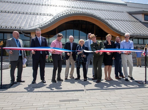
Maine DOT Officially Opens Acadia Gateway Center
May 22, 2026 States