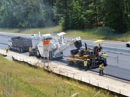
The North Carolina Department of Transportation is collaborating with technology provider one.network to translate NCDOT’s work zone information into Work Zone Data Exchange standard, which sets a standard way of sharing work zone data to third party mobile device applications.
[Above photo by NCDOT]
NCDOT noted that the Federal Highway Administration approved this new data exchange standard in January to help make highway traveling safer through a more efficient way of accessing data regarding work zone activities nationwide.

“This improvement will lead to more timely updates for travelers using third-party map apps, making our work zones even safer,” explained Kelly Wells, NCDOT’s traveler information engineer who oversees the department’s DriveNC.gov website, in a statement – adding that there are currently about 300 work zones for NCDOT construction or maintenance projects across North Carolina.
“And while it may seem a long way off, this new functionality will be needed for us to better communicate with autonomous and connected vehicles in the future,” she pointed out.
Currently, many states use their own way of communicating information about work zone activity – requiring manual data updates by third-party travel apps. States even have different ways to describe road conditions, with some using “breakdown lane” when referring to the “shoulder,” while others use the term “blocked” when referencing a closed lane, which can cause further confusion for interstate travelers.
James Harris, one.network’s founder and chief executive officer, said that by contrast the Work Zone Data Exchange makes all of that data uniform: adding that while the NCDOT has joined a handful of other states that have implemented the exchange, it is the first to take it statewide.
“We’re thrilled to be working with North Carolina and their innovative traffic management group,” Harris noted. “Making work zone data available in real-time is crucial to saving lives and reducing congestion and NCDOT is putting a stake in the ground.”
 States
Washington D.C. Launches E-Bike Food Delivery Pilot
July 18, 2025 States

