
A new “Space Act” agreement between NASA and the Port Authority of New York and New Jersey will allow the two agencies to collaborate on a study of Urban Air Mobility or UAM airspace needs in and around the “complex airspace” surrounding the airports, docks, and other facilities managed by the port agency.
[Above photo by the NY/NJ Port Authority]
That joint work will involve the study of unmanned drones and electric vertical takeoff and landing or eVTOL aircraft for moving both cargo and passengers.

NASA said it selected the port authority for this agreement specifically for its “operational knowledge” of the “constrained airspace” around the agency’s three major airports – LaGuardia, Newark Liberty, and John F. Kennedy or JFK International – as well as the potential strength of the regional market UAM travel demand.
As part of the agreement, the port authority – a bi-state agency that builds, operates, and maintains those three aforementioned airports as well as bridges, tunnels, bus terminals, a commuter rail line, seaport, and the 16-acre World Trade Center campus – will act as a liaison with airlines and other interested parties and help select scenarios for more NASA research.
This five-year non-reimbursable Space Act agreement will also include milestones for conducting simulations, the development of new procedures, and building a concept of operations together. NASA noted that such non-reimbursable Space Act agreements are mutually beneficial agreements that further its missions, with each partner bearing the cost of its participation and no funds being exchanged between the parties.
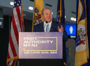
“For more than a century, [we’ve] been a leader in applying new ideas in order to make better and more efficient use of resources, brainpower and infrastructure,” said Port Authority Chairman Kevin O’Toole in a statement.
“From the historic engineering feats of our bridges and tunnels, to the birth of containerization and the shipping industry that now powers the global economy, to the outsized role our airports have played in shaping international air travel, the Port Authority knows what it means to be forward-looking,” he said. “We are excited to work with NASA to help push the Urban Air Mobility industry forward.”
In addition to this NASA initiative, the port authority said it has been developing a drone program to help maintain its bridges and inspect piers at the Port of New York and New Jersey. Among a variety of early focal points, the partnership will address eVTOL aircraft as potentially sustainable transit to airports for use in short flights under 200 miles, along with other uses.
State departments of transportation across the country are also involved in similar drone and eVTOL research efforts.
For example, in December 2021, the Minnesota Department of Transportation and NASA began conducting joint tests of advanced technology cargo aircraft and passenger air taxi services in order to provide “more dynamic aviation options” for state residents.
The Minnesota DOT-NASA partnership included a series of five workshops where the Minnesota DOT and stakeholders from across the state work with NASA’s Advanced Air Mobility team to identify areas of opportunity and concern regarding Advanced Air Mobility integration, as well as discussion of strategies for future engagement and planning.

Meanwhile, the North Carolina Department of Transportation began testing a new ‘tethered drone’ system in conjunction with the agency’s highway patrol service to improve safety on North Carolina roadways in February 2022.
The agency’s incident management assistance patrol or IMAP and its Division of Aviation plan to test drones tethered to specific IMAP vehicles to help responders assess incidents, provide situational awareness to NCDOT’s Statewide Transportation Operations Center or STOC and Traffic Management Centers or TMCs, and assist with overall traffic management of the incidents.
And, in February 2023, the Mississippi Department of Transportation took home a 2022 Digital States Survey Award in the transportation category for its years-long use of light detection and ranging or LiDAR drone technology as part of its infrastructure project management processes.
 Nation
Research Project Helping ALDOT Maintain Roadsides
June 12, 2026 Nation