The Illinois Department of Transportation has issued a new Illinois Official Highway Map, which includes updates to listings and locations of colleges and universities, Amtrak service, tourist attractions, and recreational areas across the state.
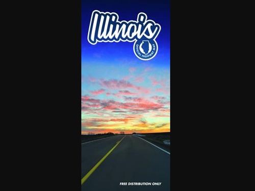
[Above image via the Illinois DOT]
The map also helps commemorate the 100th anniversary of Route 66 – which occurs in 2026 – with updates that better represent the alignment of the historic road, the agency said. The paper maps feature QR codes to connect to IDOT’s Getting Around Illinois for travel conditions, Amtrak, the Office of Tourism’s Enjoy Illinois campaign as well as Illinois Department of Natural Resources historic sites and parks.
The map’s cover features a picturesque sunset along U.S. 34 between Mendota and Princeton, near La Moille: a photograph taken by Trisha Thompson, Region 2 engineer for the agency, that won Illinois DOT’s employee map cover contest.
“While your first choice for directions these days typically is a phone, paper maps continue to be popular with the public,” noted Illinois DOT Secretary Gia Biagi in a statement.
“They also are invaluable [for] you never know when cell service will drop in an unfamiliar area,” she said. “It’s good practice to keep a paper copy on hand for these situations as well as for travel planning.”
Illinois DOT added that its highway map – funded through the Federal Highway Administration – is published every two years on recycled paper and printed with vegetable-oil-based inks.
Several state departments of transportation have published new highway maps this year, including the Oklahoma Department of Transportation, the Missouri Department of Transportation, and the Wisconsin Department of Transportation.
 States
KYTC, FHWA Seek Input on Preservation Act Agreement
June 18, 2026 States