The National Capital Region Transportation Planning Board within the Metropolitan Washington Council of Governments approved a new long-range transportation plan for the area surrounding the nation’s capital, dubbed Visualize 2045, by a vote of 29 to 2 on Oct. 17.
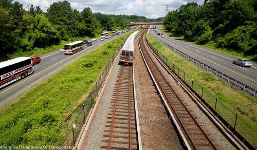
[Above photo of Metrorail subway by VDOT.]
The group said the new plan consists of more than 600 highway and transit projects totaling $291 billion that the region expects to fund over the next 27 or so years, with new major additions to that road map including:

- In Maryland, managed toll lanes on I-495 and I-270 and widening of US 301, MD 201, and MD 97.
- In Montgomery County, MD, five additional segments to its Bus Rapid Transit network.
- In Virginia, widening of US 15 while changing both the completion date and the number of High Occupancy Toll lanes in each direction on the northern portion of I-495.
- In the District of Columbia, adding six additional segments to its bicycle lane network.
- For the Washington Metropolitan Area Transit Authority, adding capacity to the Metrorail subway system, such as by operating 100 percent 8-car trains during peak periods.
The board added in a statement that, during discussions before adopting the new plan, some local Maryland jurisdictions “expressed concerns” about the impact of the I-495 and I-270 managed toll lanes project on their communities.
However, those issues were addressed by the Maryland Department of Transportation, the broad said.

It also noted that the new long-range plan now includes a set of seven “aspirational initiatives” designed to help “potentially address” some of the region’s biggest transportation challenges in the future, including:
- Bringing jobs and housing closer together.
- Expanding bus rapid transit and transit ways.
- Moving more people via the Metrorail subway system.
- Increasing telecommuting and other commuting options.
- Expanding the express highway network.
- Improving pedestrian and bike access to transit services.
- Completing the region’s 60-mile long National Capital Trail bicycle “beltway.”
 States
KYTC, FHWA Seek Input on Preservation Act Agreement
June 18, 2026 States