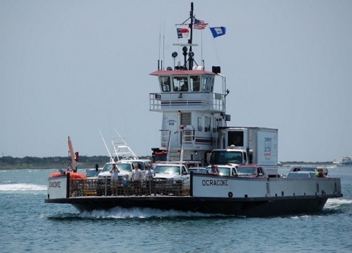
The U.S. Department of Transportation designated the North Carolina Ferry System (NCFS) as a marine highway project on October 22: a first for the state.
[Above photo by the NCDOT.]
The agency’s Maritime Administration noted that marine highways are “navigable waterways” that are used as “alternate options” to traditional transportation methods – such as highways – for moving freight.
That designation also enables the NCFS to apply for federal funding that can be used to modernize its vessels and improve infrastructure at terminals, the agency noted in a statement; further allowing for the streamlining of maintenance to meet the region’s needs of efficient transportation of freight and vehicles.
For example, in June, MARAD disbursed $9.5 million in grants to eight marine highways projects via its America’s Marine Highway Program or AMHP; funds aimed at enhancing navigable waterways and expanding existing waterborne freight services in 10 states along with American Samoa.
Located on the M-95 Marine Highway route, the USDOT said that the NCFS is an “underutilized, expansive network of navigable waterways” that connects eastern North Carolina to rural communities of the Outer Banks’ barrier islands. The ferry system serves as a lifeline, carrying supplies, equipment, and other consumable goods to these islands, it said.
The century-old, state-run NCFS is also the second largest ferry system in the nation, currently transporting approximately 800,000 vehicles along seven regular routes annually.
Operating 22 ferries that transport 9,000 trailer trucks yearly, the NCFS has reduced almost 200,000 miles of landside traffic while serving as an “economic boon” to the region – generating $18.1 million in vehicle cost savings, $13.9 million in travel time savings, and $8.3 million in safety benefits.
 States
Podcast: Flashing LED Lights Can Boost Roadway Safety
December 5, 2025 States

